


Need GPS Directions?
Lat & Long for Chalets: 45.748061 -63.136282
Lat & Long for Office: 45.749903 -63.125070


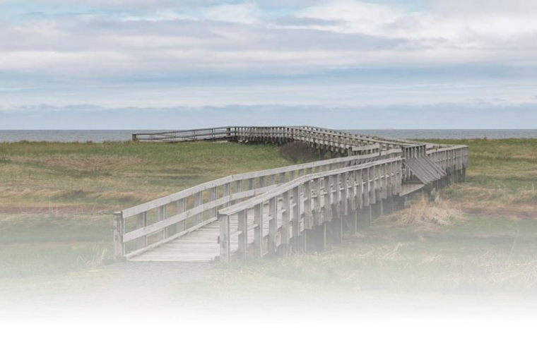
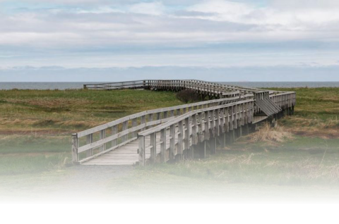
Amet View
Chalets

Amet View
Farm Houses

Amet Farm
& Office

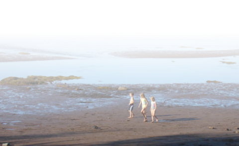
Our Sandy
Beaches
It’s All About Location
Amet View Chalets & Farm Houses are located on the beautiful Sunrise Trail which gently makes its way along the warm sandy shores of the Northumberland Strait skirting rural Nova Scotia. All Chalets have beach right-of- way and face the ocean waters with views to Amet Island. We are only 1 1/2 to 2 hours from metro Halifax, 11 kms (7 miles) east of Tatamagouche, 40 kms (25 miles) west of historic Pictou and the P.E.I ferry. We are five minutes from River John offering all the amenities and just 2 minutes from Rushston's Provincial Beach Park. Golfing, kayaking, marina, fishing wharfs, cross country trails, fine dining, shopping and historical sites are all just minutes away. Click here for my “Sites to See”.Directions From Metro Halifax Area
• Take highway 102 to Truro; take exit 14A to your right and turn right at the stop sign (end of the off ramp) onto Rte #2 • Travel approx. 5km and turn left onto Hwy #311 North towards Tatamagouche • Travel approx. 20 minutes to Earltown and turn right onto Hwy #326, Denmark Rd. • Travel approx. 20 min. to a stop sign and flashing red light and turn right onto Rte. #6, Sunrise Trail • Travel 3 min. (1 km past Pictou County line) you will see Chalets on your right at Amet View Lane • Keep traveling 4 driveways past the Chalets to Amet Farm #646 on your right to check-in first.
Amet Island
& Lighthouse

Amet View Chalets © 2016


Amet View Chalets © 2016

Need GPS Directions?
Lat & Long for Chalets: 45.748061 -63.136282
Lat & Long for Office: 45.749903 -63.125070

It’s All About Location
Amet View Chalets & Farm Houses are located on the
beautiful Sunrise Trail which gently makes its way along the
warm sandy shores of the Northumberland Strait skirting
rural Nova Scotia. All Chalets have beach right-of-way and
face the ocean waters with views to Amet Island.
We are only 1 1/2 to 2 hours from metro Halifax, 11 kms (7
miles) east of Tatamagouche, 40 kms (25 miles) west of
historic Pictou and the P.E.I ferry. We are five minutes from
River John offering all the amenities and just 2 minutes
from Rushston's Provincial Beach Park.
Golfing, kayaking, marina, fishing wharfs, cross country
trails, fine dining, shopping and historical sites are all just
minutes away. Click here for my “Sites to See”.
Directions From Metro Halifax Area
•
Take highway 102 to Truro; take exit 14A to your right
and turn right at the stop sign (end of the off ramp) onto
Rte #2
•
Travel approx. 5km and turn left onto Hwy #311
North towards Tatamagouche
•
Travel approx. 20 minutes to Earltown and turn right
onto Hwy #326, Denmark Rd.
•
Travel approx. 20 min. to a stop sign and flashing red
light and turn right onto Rte. #6, Sunrise Trail
•
Travel 3 min. (1 km past Pictou County line) you will
see Chalets on your right at Amet View Lane
•
Keep traveling 4 driveways past the Chalets to Amet
Farm #646 on your right to check-in first.